
Translation: Réunion, aspects of its colonisation and settling
The evolution of Réunionese society as dictated by its climate and agriculture

Preface
While my main translation project (the memoirs of French colonial governor Joseph Dupleix) still languishes in editing hell (any day now I promise), I thought I’d try my hand at something a little less ambitious. This essay was written by the relatively influential French geographer Hildebert Isnard in 1950. First an expert on Algerian history, colonisation, and agriculture, he quickly turned his attention towards the other warm-climate colonies that the French occupied.
This document combines a (relatively) concise but global summary of the history of Réunion up to the early 20th century and speculation about its demographic and sociological trajectory based on past experience and current trends.
Most of it is devoted to the main crops grown on the different parts of the island, throughout the years, as well as sometimes extensive digressions about the economics involved behind the exploitation of said crops. The contents help to answer the question of how Réunion society is so ethnically diverse today and the consequences this had on the people living there as well as the adaptability of European farming techniques to unusual locales, while also shedding light on post world war II French anxieties regarding the fate of “the colonies”, and the relationship of these far-flung locales with their capital.
I’ll use footnotes to elucidate where I think it’s necessary, there’ll also be links to my other writings on the topic of the island for people who want to dig a little deeper. Be aware, it’s a very long post!
Hildebert Isnard - In: Cahiers d'outre-mer. N° 10 - 3e année, Avril-juin 1950. pp. 101-122
How, pushed by the necessities of history and guided by the latent possibilities of the natural world, men carry out the seizing of the soil through which the differentiation of regions within a unified geographic area takes place, is what is shown, at the scale of a laboratory experiment, by the history of Réunion’s colonisation these past three centuries.
Natural conditions
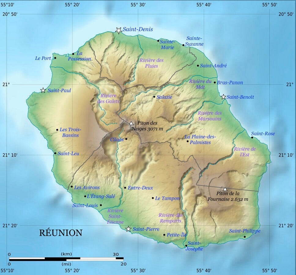
Under the 21st degree of Southern latitude, volcanos, successively becoming active from the NW to the SE, along an oceanic crack in the planet’s crust, raised up a series of juxtaposed cones, forming the island of Réunion.
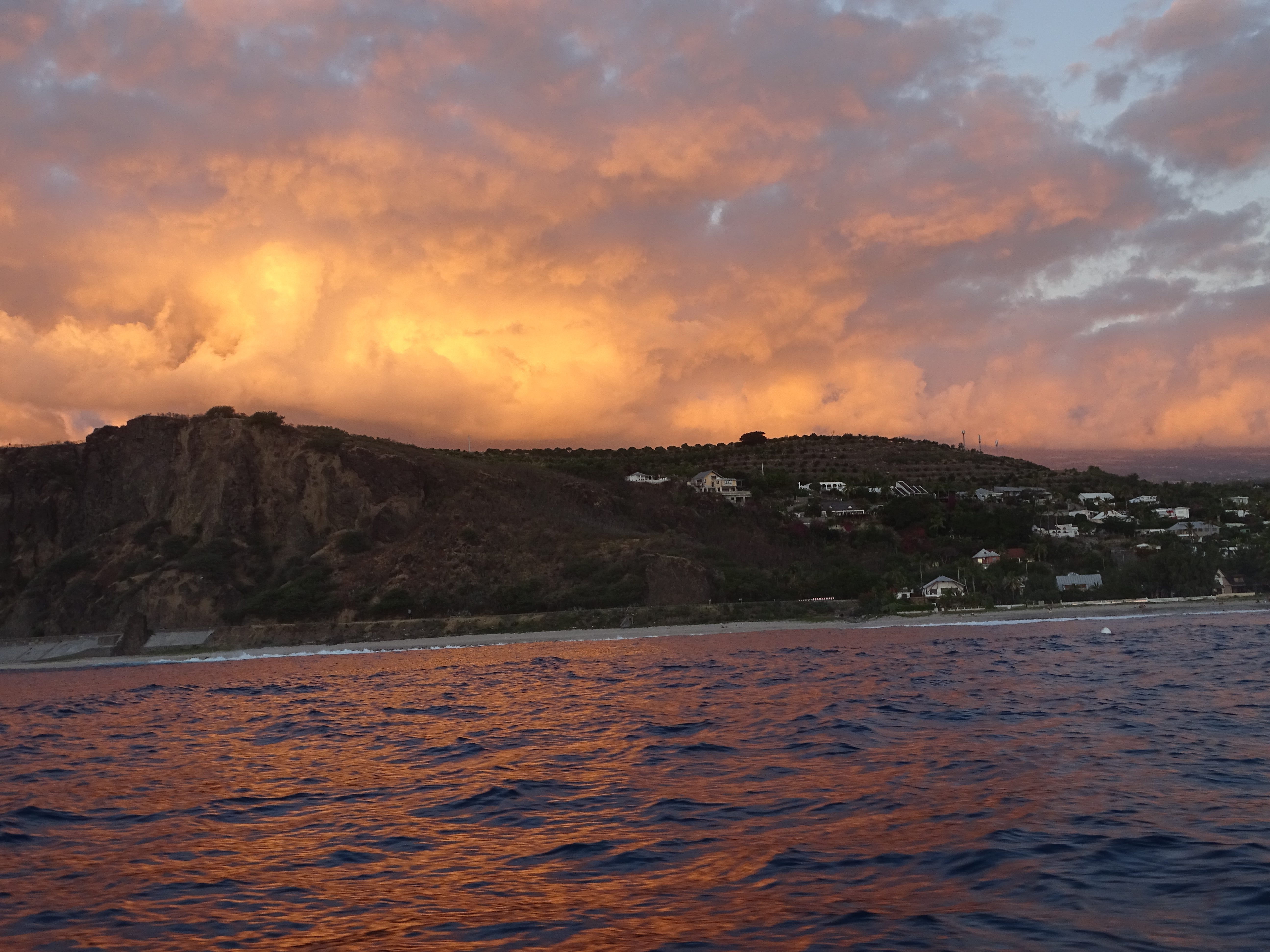
Using radial slits or collapses, erosion dug vast contiguous water basins in the walls of this gigantic device: the “Circuses” (Mafatte, Cilaos, Salazie), circumscribed by steep cliffs, the “Ramparts”, whose connections uphill form the hills and mountains (Piton des Neiges, 3069m) and which close downhill into narrow gullets. Between the circuses, the sides, cut into triangular mesas, quickly dip towards the periphery: these are the “Plains” (Plaine des Merles, des Makes, des Cafres, des Salazes, des Marsouins, des Fougères, des Chicots), which form a complete belt, at mid-height, around the massif. At last, the work of a multitude of radiating torrents, over-excited by the incline, accumulated on the shore a layer of rolled stones: the Pebbles, which form a coastal plain which widens out in places, into deltas (plaine des Galets, delta de la Rivière du Mât), and cut, sometimes, by flows, especially in the SE, where the lava, coming down from the still active Fournaise volcano, reach the sea as a 10-kilometre front, between the Ramparts of the Tremblay and the Bois Blanc (Grand Brûlé) (fig. 1).1
Climatic differences, born of exposure and altitude, complete the differences between these diverse regions. The whole island is under the effect of the south-eastern trade wind for most of the year; and to that of the north-eastern Monsoon during the austral summer, which frequently brings devastating cyclones. These moist breezes let loose abundant rainfall on the first cliffs they climb over; but condensation diminishes when, as the crests are overcome, they compress while going down the opposing cliffs. Such is the mechanism which can be understood in all its simplicity, from the foot of the Piton de la Grande Montée, on the interior road between Saint-Benoît and Saint-Pierre: to the North-East, thick fogs, brought in by the breeze, slither into the valley of the Rivière Sèche, invade the Plaine des Palmistes, rise up on the lichen, heath and tree-fern covered cliffs; then they spill over onto the other side, come apart and vanish on the dry heath of sparse gorse clumps in the Plaine des Cafres, where the view leads south-west, in the clearness of a luminous atmosphere, into the ends of the sea and sky.
Thus, the island’s major axis, between the Pointe des Sables Blancs and the Pointe du Gouffre, separates two sorts of regions: in the north-east, the moist windward regions (from 1.5m to 4m of rainfall per year); to the south-west, the dry regions under the wind (less than 1.5m of rainfall per year). To this division is added that resulting from the temperature differential between the levels from the foot to the summit of the mountains; with altitude, the thermal regime, tropical in the coastal plains, becomes temperate in the circuses, where July holds a few days of freezing temperatures, and even cold at the summits.
This diversity of natural conditions was only exploited by Humans recently.
History of Colonisation
At the beginning of the XVIIIth century, the island, still uninhabited, covered in forests, crawling with animals, seemed like an Eden to sailors who stopped there: the sick quickly recovered their health; “refreshments”, necessary after long weeks spent at sea, abounded: birds that let themselves be killed with sticks, fat eels, enormous land turtles with delicate flesh. There was such a massacre of these animals that they disappeared, some, like the dodo, forever.
In 1649, the colonial era begins. Having become French under the name of Bourbon, the island comes under the authority of the East Indies Company, which sets up a supply depot for its ships trading with Pondichéry: it asks the colonials settled in the coastal plains, successively at Saint-Paul, Saint-Denis and Saint-Suzanne, to provide fresh provisions. Helped by Malagasy, then African, slaves, the “inhabitants” raise poultry, pigs, cows, which, during the dry months, go into the mountains to feed on tree leaves: they grow wheat, Europe’s vegetables, tropical plants: rice, sugar cane, whose fermented juice, or forangorin, replaces unaffordable wine.
But, in 1715, Bourbon, long reduced to the role of an unknown stopover, seems to have, suddenly, risen to the rank of the famous “Islands”: not only does it possess an indigenous coffee plant, but acclimatation experiments with moka were crowned with success.
The Company hurried to provide the colonials with the means to expand the rich plantations: it ceded them lands against payment of a fee of four ounces of coffee per arable acre, it multiplied the imports of slaves from Madagascar. Such was the enthusiasm that the production of supplies was neglected for the more profitable one of coffee, despite Mahé de la Bourdonnais’ words of caution, who predicted the moment where “The Isle will produce two million pounds of coffee, and later five to six, which’ll be more than the Company will know what to do with.”
The peopling of the coastal plains and the first cliffs went hand in hand with the expansion of the plantations: cities and villages of colonials and their servile workers multiplied along the coastal roads, while the inside of the massif, inaccessible and wooded, became a refuge for fleeing blacks: the Maroon negroes, against whom the Militia conducted punitive expeditions from time to time.
The colonisation of the “heights”, the plains and circuses, will be the work of the XIXth century, during which the Réunionese economy will take a new direction. The crisis predicted by Mahé de la Bourdonnais didn’t fail to materialise: from the middle of the XVIIIth century, the price of coffee collapsed with the introduction of competition from the Antilles; the East Indies Company fixed the yearly quota of its Bourbon coffee acquisitions to three million pounds and encouraged the colonials to return to their old food crops, mostly wheat. But the latter, mostly seeking the more profitable export products, adopted the new cultures that had just been introduced to the island: that of cinnamon, vetiver, coco, to which clove and nutmeg were added in 1770-1772, acclimated by the steward Pierre Poivre, and, around 1820, vanilla. The era of “spices” succeeded that of coffee, which was to last until the end of the first third of the XIXth century, the time of the decisive progression of the sugar cane.
From 1815, Réunion possesses a sugar refinery and exports 21 tons of sugar; in 1860 sugar cane occupies 62.000 hectares (70% of arable land), providing for 116 factories which produce 68.469 tons of sugar for exports.
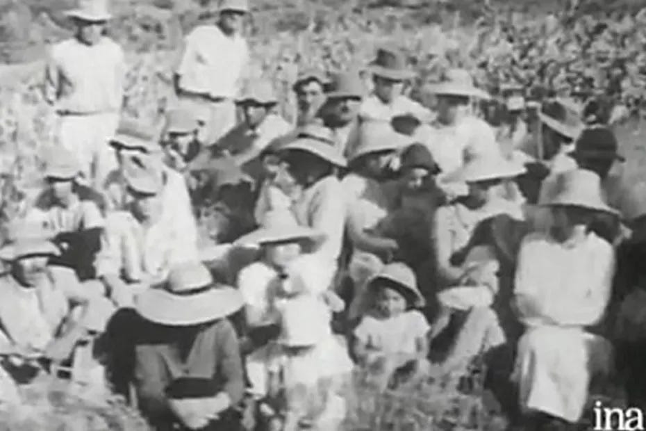
How to explain this prodigious effort? Withdrawn into itself during the revolutionary and imperial wars, Réunion renews, once peace is re-established, its trade links with France; this country is lacking in sugar, the new cultivation of sugar beet, which is no longer encouraged, stagnates; to satisfy consumer demand, significant imports are required: if the little Antilles remained producers, Saint-Domingue is ruined by civil wars, there is room, on the Metropolitan2 marketplace, for a new supplier. Always looking for a speculative crop, which would allow them to quickly amass a fortune sufficient to return to France, the leading Réunion colonials started sugar cane plantations, with all the more passion as cyclones, that of 1806 in particular, had ravaged their coffee plantations. The lack of manpower resulting from the abolition of slavery in 1848 slowed down the plantations for a time; but these restarted with even more vigour after the decree of the 27th of May 1852 which gave Réunion sugar a long-distance tax refund: the surface dedicated to cane doubled in four years, going from 27.000 hectares in 1851 to 56.500 hectares in 1855. It covered the coastal plains and rose up the first cliffs up to 600 metres of altitude. The factories multiplied along the Route Royale, which, since 1829, connected the communes of the coast. This was the colony’s golden age. The profits from each harvest were invested in land increases: “this industry had emboldened the large landowners to expand their properties by paying a high price for the land of the proletarians.” These sold all the more easily since the freeing of the slaves had led to significant losses for them and that their land had become harder to manage: primitive concessions had indeed been drawn up perpendicularly to the shore, so that they could be furnished with low lands, high lands, and forests; sharing through inheritance had tended to conserve this structure, so that after two centuries, the concessions found themselves divided into an infinity of properties with a width between 1.5 metres and 40 to 50 metres, extending from the coast to the mountains with a length of seven to eight kilometres. Attracted by these unexpected prices, many small landowners sold lands that they couldn’t expect another profitable sale from. What would they become? Some emigrated: their traces could be found in Madagascar and even in Java. Most stayed on the island. The cultivation of the vast sugar cane plantations could offer profitable work to a numerous workforce; but, to put a stop to wage inflation, the colonials made use of immigration: from Indochina, Madagascar, Mozambique, the Comoros, Djibouti, from India, especially, workers flowed in their tens of thousands, men, women and children hired on contracts for two, three or five years. In 1860, out of a total of 200.000 people, the island counted more than 64.000 immigrants.
The competition was now unfavourable to the poorer colonials, deprived of land and with little desire to regress socially by accepting the conditions of salaried workers, once reserved only for slaves. On the other hand, the massive influx of foreign agricultural workers worsened the overpopulation that the coastal plains were suffering from because of the high natality of the inhabitants; it had furthermore sown the seeds of a serious tropical plague: malaria, introduced around 1867 by coolies from Calcutta. There was nothing left to do but to abandon the now inhospitable plains.
Thus, the exodus towards the heights, which had began early, increased in the middle of the XIXth century: it drew Black freedmen who, to avoid mandatory work, settled the first cliffs, and especially poor ruined Whites, the vanquished of an out-of-control colonial economy, who travelled deep within the old maroon country.
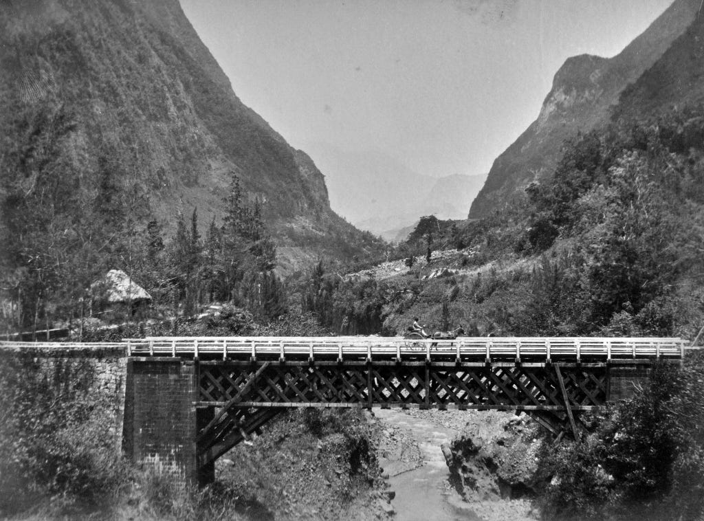
The population of the area under the wind underwent a significant increase. To facilitate the settling of newcomers, governor Henri-Hubert Delisle (1852-1858) decided to open new roads that followed the contours of the land, similarly to the Chemin de Ligne, which had been build between 1785 and 1789, between 400 and 600 metres of altitude, out of reach of the ships moored by the shore. Sowing themselves along these roads, the houses formed the long villages so typical of the region.
The problem of the cultivation of the soil also needed to be solved: the coffee tree, which the invasion by Hemileia vastatrix3 in 1882 pushed to extinction, sugar cane and tobacco already rose to 600 or 700 metres; but the population increase required that the wooded lands at higher altitudes be put to productive use: this happened following the introduction in 1880 of the geranium which grows on clear-cuts up to 1000 metres of altitude. Beyond that altitude, it’s on vegetable cultivation and cattle-farming that the peopling of the Plaine des Cafres and Plaine des Palmistes rested on.
The colonisation of the circuses, slower, continued into the first quarter of the XXth century: it was the work of small family units which infiltrated through the lonely woodlands. First practicing a kind of forest nomadism comprised of gathering and temporary crops, they slept under shelters made of foliage or boucans4. Then they settled by building huts of wooden planks with wooden roof shingles: some gathered into hamlets. Others spread out as far as they could: such was the genesis of the islets, inaccessible, as if fear for one’s safety had prevailed over any other consideration.
Belonging to the collectivity, these circuses were “standing forests”. Then began the dramatic struggle for the conquest of arable land: it was a mass uprising against the forest. Everywhere, fires broke out, the public lands were invaded, despite strong interventions by the gendarmes and the forestry department. Overcome by the extent of the movement, the administration had to admit defeat: it recognised the usurpations and contented itself with sending surveyors to divvy up the occupied plots. Having long been isolated inside the ramparts, the inhabitants lived withdrawn into themselves, with their crops of maize and legumes, their rearing of cows and poultry, and gathering wild fruits. But a change would soon begin to take place. Fleeing the difficult rainy season, the “coastals” began climbing into the circuses for “a change of air”, to enjoy the fresh temperatures and the virtues of the hot water springs: the people of the heights took care not only of the supplies but also of the transportation of the visitors, in armchairs, on steep and rocky paths. At last, the opening of the roads having facilitated relations with the coast, they extended the food crops that were suggested by the natural conditions: vegetables and fruit trees from temperate countries, trelisses of grape vines whose production mostly flowed to the coastal cities.

Thus, at the end of this story of the settling of the land by men, three groups of regions end up forming on the island of Réunion: spread over the coastal plains, the realm of sugar cane, which is succeeded, in the heights and plains under the wind, by the realm of tobacco and geranium; in high altitude, in the circuses, the realm of vegetable crops and orchards.
These zones also differ by the characteristics of the people living there.
The coastal plains and the first cliffs
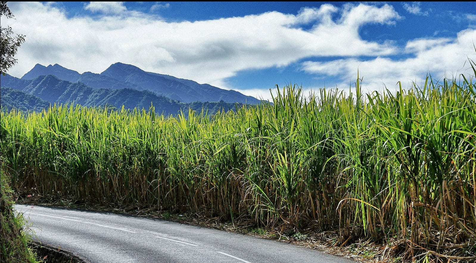
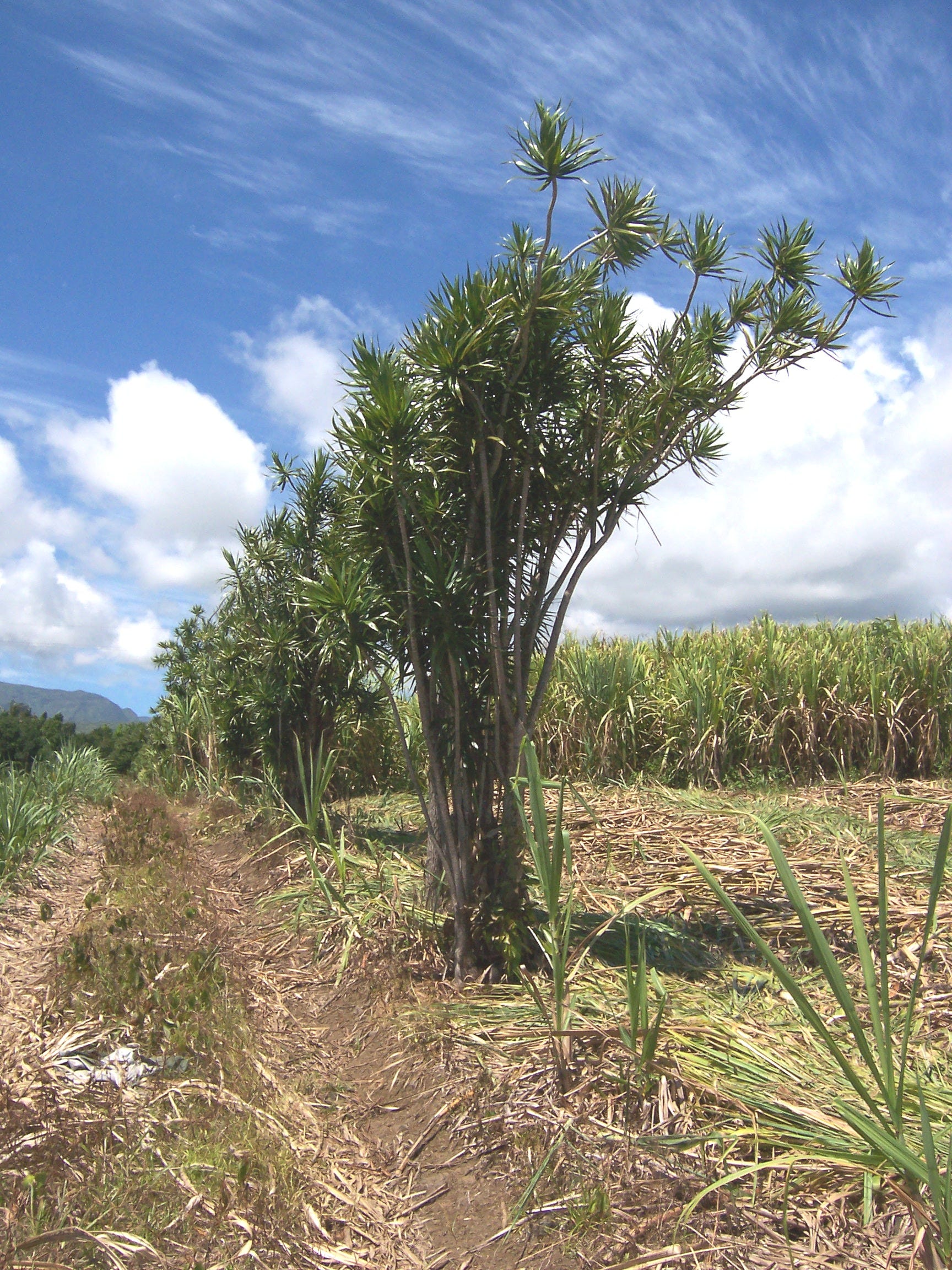
The sugar cane plantations are located on the coastal plains and the first cliffs of the massif, the first to be colonised. The climate, as we’ve seen, allows one to distinguish between the moist windward lands and the dry lands under the wind. In the former, the canes are only separated from the sea by a belt of pebbles, and it rises to 500 metres of altitude, except above Saint-Denis, where the Mountain and the Brûlé are populated with summer homes hidden in the azalea and camelia bushes. The rocky beds of the torrents, a few maize and manioc fields, occasionally interrupt the continuity of the plantations, ; however, at Sainte-Suzanne, Saint-André, Champ-Borne, these are intercalated with vanilla plants supported by physic nut. When the vanilla plant separates from the cane, it requires the shade and support of the filaos and vacoa (Pandanus), which form in the low valleys of the dry ravine, at Saint-Anne and Saint-Rose, clearly delineated thickets. With the recent appearance of the lava flows of the Grand Brûlé, vanilla becomes the only resource; it’s grown under the forest canopy: on each side of the begonia-decorated road, it embraces the trees, mixed with giant bramble5 and other orchids. A few scratches on the soil, the artificial fertilisation carried out by children in March-April, the picking by the women in August, are the only work this family crop requires. The produce is sold to “preparators” who handle the delicate operation of drying the green beans: these are specialists who pass on their little secrets from father to son. Today, the administration tries to turn them into tradesmen working for united co-ops of producers, but this initiative is foiled by the crisis of low sales that happened after the United States, their main client, paused its orders.
From Saint-Philippe onwards, sugar cane takes possession of coastal land once again, mixed with small fields of maize and manioc; at Manapany, it reaches the seaside.
But soon, as the climate becomes dryer and dryer, it tends to seek refuge on the wetter hills, which it occupies up to 700 or 800 metres of altitude, abandoning the plains to the xerophilic vegetation of tree-spurges, agave and filaos. It’s especially between Saint-Louis and Saint-Paul that all the life of the cane is concentrated above 300 metres of altitude, while a reflective, scorched desert spreads out under the Chemin de Ligne, yellowed by dry grasses which have, in places, colonised the fields which were abandoned by sugar cane; a few herds of goats and cows bring life to the desolation.

The dryness is greatest in the Plaine des Galets, corresponding to the delta that the Rivière des Galets created upon its exit from the Cirque de Mafatte: a veritable Reunionese Crau6, it’s formed by a layer of smooth black pebbles, of all sizes, ill-concealed by the low-lying grass, cactus-shrubs and agaves. Close to the delta’s point the pools of the island’s only harbour were excavated, that the railway and a 46km and uneven road barely connects to Saint-Denis.
In total, the plantations of the plains and the cliffs covered, in 1948, an estimated surface of 22.000 hectares, more than two-fifths of arable land, the production of which reached 782.682 tons of cane more or less equitably divided between the windward region (404.932 tons) and the regions under the wind (377.750 tons).
It seems that this is a maximum extent, including even partially exhausted lands or difficult-to-reach plots, which only carry cane because the latter, benefiting from the prices and production given to sugar beet in the Métropole, is a very profitable crop. It’s also a crop that confers a little bit of the prestige of the old local aristocracy which owned the sugar refineries around which gathered lands worked on by flocks of slaves. Without a doubt, the planters would say, but it’s also the crop that’s best able to endure cyclones while the coffee, trees and coco are uprooted or broken in two. Let’s add that it’s most of all the easy way: it requires neither specialised knowledge, nor long training, nor fastidious methods, nor the assiduous care of workers, who thus, stayed basic.
All these reasons explain why sugar cane is seen so favourably, as it became the monoculture of the island’s best lands, to the point that Réunion must request imports of most of its food: rice, wheat, meat, coffee.
Working in the sugar cane fields is what dictates the lives of most of the island’s inhabitants. From July to March the cuttings are planted in holes in the ground, at a depth of 0.3 metres and spaced out 1 metre each on lines spaced out 1 metre 60, or a density of 6000 plants per hectare. A little weeding, some trimming in May, at the beginning of the dry season, to facilitate maturation, are the only tasks before the first harvest, eighteen months after planting. Three more yearly cuts and the cane is uprooted, except for smallholders, who can draw seven or eight harvests from them.
The sugar season is open following a prefectural decision, following the opinion of a consultative committee, generally during July, it lasts until November: the dry season is thus a time of intense activity. The cutters are at work early in the morning: armed with a straight-bladed saber, broad and thirty centimetres long, they cut down the cane just above ground with a quick movement, cut off the leaves and crowns and pile it up on the side of the road; they are paid per unit: 75 CFA francs7 for a ton of cane on a chariot, in 1949. The straw which covers the ground is burned on the spot or gathered as litter for animals or roofing for huts; the tender extremities of the stems are rich fresh food for livestock. The cane is then evacuated by railroad, lorries, and especially two-wheeled chariots driven by ox, zebu or métis ones called mokas, and able to carry a 900kg load: they stretch out along the roads in long files, waiting for their turn at the factory’s scales.
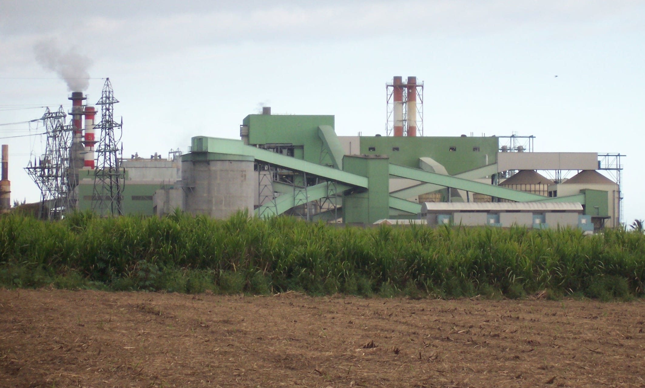
The role of the planter is over, but that of the sugar refiner is only beginning. This work is industrial: it involves a complex apparatus of machinery, necessary for the extraction of sugar: cranes, conveyor belts, fiber extractors, mills, sets of liming pools, decantation pools, filters, devices to concentrate, to cook, to mix, to propel the sugar through turbines… a gigantic electrical organism which uses the dry cane fiber as fuel; some deploy a force of 1000 horsepower enabling 1000 tons of sugar cane to be treated per day. From his laboratory, the chemist oversees the operations. Each sugar refinery has an annex containing a distillery, containing vats where the molasses, which are partially depleted, ferment, and a permanent still which distills a 94° alcohol which is brought down to 45°. White rhum is left to age for a few years in oak casks. Of the agricultural distilleries, which contented themselves with producing rhum with syrup brought from neighbouring sugar refineries, a single one still survives in Saint-Pierre.
Such installations presuppose the mobilisation of significant amounts of capital: this necessity led to the disappearance of the weaker factories, as technical progress dictated that more expensive devices be used. Réunion counted 116 sugar refineries in 1860, 31 in 1902, and, in 1948, only 14, one of which, incapable of modernising, will soon fail. This concentration took place to the benefit of rich citizens, and especially of powerful anonymous corporations, such as Les Sucreries Coloniales and La Société Anonyme des Sucreries de Bourbon, which owns three of the best factories on the island.
These 14 refineries are spread out in the middle of the plantations: 7 in the windward regions and 7 in the regions under the wind. But they didn’t delineate their respective areas of influence through an agreement that would completely avoid competition: by agreeing to rebates on their transportation costs, some try to attract the planters.
The refineries don’t buy the canes they process: they apportion to their customers, pro-rated based on the quantity they provide, two-thirds of the proceedings from the sale of sugar, and keep the last third as payment for the processing. They have long kept all the by-products of refining; recently they’ve had to consent to sharing the net profits on the sale of alcohol, according to the rules applied to sugar; but they still freely dispose of all the filtration residue used as fertiliser and of the dry cane fiber, used as fuel in their thermal generators; the electrical energy produced by one of these in a refinery near Saint-Louis is so plentiful that the factory was able to offer the city to sell it the energy required for public lighting for part of the year.
The harvest lasts 120 days, at the end, the divvying up of accounts takes place: the administration calculates the average sugar yield per hundredweight of canes, obtained in each of the areas, the windward and under the wind; these are the respective rates that are used for the calculation of the individual portions, by the factories working in each area, no matter what their own percentage is. This solution is thought to prevent more modern factories from monopolising the sugar canes, but it takes into account differences in productivity that the climate causes between the two areas: the drier area under the wind produces canes that are richer in sugar than the windward ones; in 1948, the yield was of 10.16% for one area, against 9.74% for the other.

The current system of rules doesn’t satisfy the planters, who are sometimes openly hostile to the factory owners: they consider that, once inside the building, the cane is theirs: some claim ownership of all the products and by-products of the canes they bring to the refinery, others that the sugar belongs to them, the factory workers merely processing the product and, as such, only needing to be paid in cash for their services. Until this point of view triumphs, the planters demand that their portion be increased from two-thirds to three-quarters of everything extracted from their canes.
The yields in sugar extracted from the canes in Réunion didn’t increase proportionally to the perfectioning of extraction techniques: they were 8.97% in 1880; 8.94% in 1885; 10.07% in 1893; 10.46% in 1941 and 9.93% in 1948. If most factories didn’t balk from the expenses that the modernisation of their machinery required, their processing capacity doesn’t allow them to treat all the canes when they reach their peak sugar content, that is to say in September, they thus work a long time before and after this peak, on the other hand, alcohol and rhum being very profitable, they have no interest in exhausting their molasses. But it’s the cultivation which bears most of the responsibility for the weakness of the yields: it uses cane varieties ill-suited to the different regions, many plots which receive no fertiliser or carry many harvests without resting are exhausted, the agricultural machinery is rudimentary. The average yield barely reaches 45 to 50 tons per hectare.
The mode of ownership is most responsible for this stagnation. The abolition of slavery and the appearance of industrial capitalism at the end of the XIXth century modified the conditions of sugar production: this resulted in profound transformations of the structure of land ownership. Besides the old “establishments” of various sizes, belonging to the “Planters”, the sugar refineries formed their own domains: 12 of them, in 1948, owned plantations which produced 240.227 tons of cane, or 31% of the total amount processed in the factories; which represents close to a third of all land dedicated to sugar cane cultivation.
Only part of the lands are under the regime of “direct ownership”: these are mostly smaller properties, between a few acres and about ten hectares, such as those owned by the descendants of slaves or Malabar wage-workers established in Saint-André. The factory-owners also directly manage about three-fifths of the extent of their domains; that’s where they get the best results. On all the rest of the plantations the regime of metayage8 rules: so much so that one is able to define the structure of sugar plantations in Réunion: “great sharecropped latifundia”.
The colonials, often recruited among the descendants of slaves, are a kind of sharecropper that the owners of the canes hire according to ill-defined verbal agreements, despite the content of the new laws; however, the normal agreement is that the planter provides a plot of a few hectares, the cuttings, and the repayable advance payments; the colonial owes his work up to the delivery of the canes to the factory; he enjoys the use of a garden of four to five square gaulettes9 (100 to 125 square metres) to grow his food, of pasture for his two cows, his poultry, and, in exchange for a slight payment, for his dairy cow. The two-thirds of the harvest belong to him, the last third is owed to the planter.
The colonial, often established on a small surface of land, two to three hectares, must complete his resources either by taking another parcel under sharecropping, either by renting his services outside for a few days a month; sometimes, he doesn’t hesitate to pay low-wage workers to finish his work for him, while he takes care elsewhere of better-paid business: regular work in a trade house, for example.
The length of the contract being indeterminate, many colonials have been settled on the same land for many years. They form with their planters a relationship based on attachment for some, paternalism for others, which the introduction of metropolitan laws might suddenly fracture, without substituting something viable. But it’s incontestable that this mode of tenure, for which it can be feared, furthermore, that it helped the survival, on the island, of mentalities incompatible with the abolition of slavery, isn’t favourable to the improvement of cultivation methods. Below the colonial, in the social ladder, the agricultural worker. For a long time, as we’ve seen, Réunion had to frequently call upon foreign workers: the last ones arrived from Rodrigues island in 1933. It was a complete failure. But the fast growth of the population, which went from 173.000 in 1921 to 212.000 in 1946, curtailed any further immigration. Today, the workforce is recruited on the spot, in the dense population of the coastal plains, where the most diverse races have mixed together in an inextricable métissage10, Kaffir, Malagasy, Hindus, Chinese, Somalis, Arabs… Sugar cultivation can thus dispose of five workers per hectare: men, women and children are employed in working the land and the factories, which, during the four months of harvesting, run day and night. They’re accused of lacking ardour, efficiency and assiduity in their tasks, for low yields, low salaries: 120 to 140 CFA francs, in 1949. They have excuses such as malaria, under-nourishment, alcoholism, which is unrestrained. Regardless, they constitute a numerous and miserable proletariat, which expects much from the transformation of the colony into a Département11. But the introduction of the fiscal and social legislation of the métropole will incur costs, most of which will fall on property: for example, the newspaper Démocratie calculated that the taxes per hectare of cane would suddenly jump from 30 francs in 1947 to 1087 fr. 50 in 1948. This is why the planters and the factory owners who form the new leading class in business and politics ask that the process of “départementalisation” be adapted to Réunion’s conditions.
The population depending on sugar cane forms around the island a high-density crown of largely more than 100 per square kilometre. It’s composed of a minority of pure Whites, the Créoles, where most of the great planters, industry workers and officials are recruited, and of a multitude of métis and people of colour: employees, shop-keepers, agricultural workers, colonials, smallholders, in the midst of which some ethnic communities have maintained their homogeneity, such as the Malabars and the Mumbai “Arabs”.
Densely grouped urbanism dominates: small cities and villages with wooden houses with verandas, roofed in wooden shingles or corrugated iron, more urbane than the humble case made of planks, in braided straw, covered with grasses or dry leaves. Buried within the dense vegetation of the banana and mango trees, settlements are spaced out along the circular coastal road, which the narrow train tracks double, from Saint-Pierre to Saint-Benoît.
The highland plains
As soon as, leaving the plains, one ascends towards the island’s summits, temperatures quickly go down. Sugar cane is succeeded by temperate-region crops: properties are fragmented, population density lowers, settlements become more and more distant. Social discipline, which weights one down below, disappears with altitude, where reigns individualism fiercely tinted with the independence of an almost pure white humanity. However the transition isn’t sudden, the first heights still belong to the cane economy, in the windward area, up to 500m where the filaos12 forests begin, and in the area under the wind up to 700-800 metres: it’s from this altitude onwards that new crops appear, the Heights of the South-West clearly stand out.
Covered by forests, these inclines were first clear-cut to make way for tobacco and coffee plantations. Since Hemileia vastatrix’s invasion, coffee almost disappeared, tobacco subsists between Saint-Paul and Saint-Pierre. Above Saint-Louis it’s granted, along with maize, stone-covered fields which form a typical landscape: the blue Maryland occupies large lanes separated by piles of stones oriented as long lines going every-which-way, here and there, a few papaya plants whose fruits are made into jam or given to the pigs. The planting takes place between May and June, and the collecting of leaves happens progressively between September and January. The plant, being unable to receive any irrigation, fears long winter droughts.
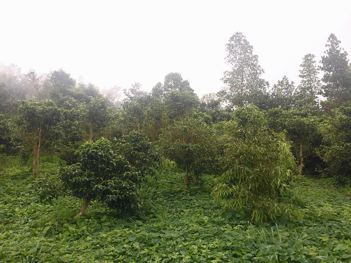
With the coffee trees destroyed, a replacement crop was needed: geranium, introduced from Algeria, immediately had such success that, not only did it substitute itself to coffee, but it conquered new lands on the primitive forest. This, on a front of 50 kilometres, retreated in 30 years by 5 or 6 kilometres; its lower limit progressively rose from 700 metres to 1200 metres. And the retreat continues: similarly to classical podzols with their discoloured upper layer and their reddish middle layer, resting on a grey area of decomposing basalt, these forest soils have a precarious fertility, which is depleted in four or five harvests; one must ceaselessly carry out new clear-cuts to obtain new lands and also the wood necessary to heat up the stills. The soil, relinquished by agriculture, is covered in sparse grasses that don’t protect it from erosion. The great flows of the rainy season cut ravines into it and degrade it. The forest’s retreat modified the regimen of the water and rains: the springs which formed under its canopy have dried up: today, the heights of the Possession, of Saint-Paul, or of Saint-Joseph suffer from thirst, precipitations have considerably lessened during the cool season, they’re less abundant on the coast, where, over the past fifty years, cane had to, in places, give way to the steppe. No other remedy for this destructive economy than the methodical re-foresting of abandoned lands: it’s only practiced in Saint-Pierre’s heights, where mimosa13 plantations are carried out in rotation with geranium.

In several areas, this nomadic cultivation goes beyond 1000 metres of altitude. Pillars of smoke signal that clear-cutters are at work. After the fires, the ground is cleared and pickaxed. The geranium is planted in rows or placed here and there, on burnt land covered in trunks or stumps too difficult to remove. It requires frequent hoeing which leaves the soil uncovered, unless one cultivates peas in-between them. A plantation produces three leaf harvests in fifteen months. In the middle of the fields the planter has set up, under a straw hut, his home-made still, which runs tirelessly during the harvest; but small travelling distilleries also go from village to village. Its high concentration in rhodinol is what makes the Bourbon14 geranium famous, its production, after having reached a peak of 173 tons in 1925, fell to 66 tons in 1948.
Another fragrant plant is cultivated in the heights under the wind, vetiver, which presents different characteristics from geranium. Vetiver holds the soil between its long, branched roots, it’s why foresters use it to fix cliffs bared of vegetation, but, if it’s able to descend quite low, its cultivation never goes beyond 600 to 700 metres.
Eighteen or twenty months after plantation the first harvest takes place, in the dry season, between June and October. Unlike the geranium leaf which must be distilled fresh, on the spot, vetiver root can be treated a long time after being cut. The operation is generally entrusted to travelling entrepreneurs, who receive a few grams of essence per “cook”, where the roots are sold to two established distilleries, one in Tampon and the other in Bras-Ponteau, who work until December with the stocks accumulated during the harvesting season. To extract the 2 tons of essence contained within 150 to 200 tons of roots, one must burn 800 to 900 tons of wood; the plantations entered production at the beginning of the century; they produced 11 tons of essence in 1948. One can measure what this crop costs the forests of the island.
To the above, one must add the food crops of vegetables, maize, fruit trees: bananas, oranges, mangoes, lychees, which reach maturity at the end of the dry season. They all have a tendency to be exploited at the family scale, but the geranium lands are often worked by sharecropper colonials. At last, the heights under the wind also raise pigs and goats that graze on the grasses of the dry cliffs.
The repartition of the crops in altitude ordered the distribution of rural settlements spread out in level lines along the roads the parallel roads established according to altitude levels. Nothing is more characteristic of this than the settling of Saint-Pierre; between the road of the Plaine des Cafres and the path of the Ravine des Cabris, perpendicularly to the coast, one can count 4 parallel roads, bordered by houses that are drawn tighter and tighter together as altitude increases: Chemin Paradis, Chemin des Bambous, Chemin des Quatre Cents, Hubert Delisle road, the backbone of the geranium region, on either side, between the village of the Tampon and the hamlet of Bras de Ponteau, huddle the tens of houses of the village of Six Cents, curiously stretched out over 7 or 8 kilometres of length.

The clear-cutting reached the Plaine des Cafres in altitude, which, between 1100 and 1300 metres of altitude, only offers the vista of a plain of short grasses, interspaced with gorse bushes and moorland where, in some areas, the dried-out trunks of cut trees jut out. Spread out clumps of mimosa, eucalyptus, filaos are the proof of a few shy attempts at reforestation. In this cool climate, temperate crops are added to geranium; in the plots of land enclosed by dry stone walls, grow peas, cabbage, artichokes, and especially potatoes. At this altitude they don’t degenerate: the Plaine des Cafres produces 800 tons per year, four-fifths of the island’s harvest: it could produce more and export some, especially seeds, but the possibility of expanding this crop is limited by issues with the difficulty and cost of transportation.
The Plaine des Palmistes, to the North-East, belongs to the windward zone, and is akin to the circuses, with its steep ramparts and its flat bottom, at 1100 metres of altitude.
The brutally exploited primitive forest is substituted with a dense thicket of tree-ferns, high heaths, giant bramble, with blooming hortensias; the small plots of brown soil dotting the area carry vegetable crops.
Despite the differences in their natural conditions, the Plaine des Cafres and the Plaine des Palmistes have similarities: animal husbandry is important here; the livestock, sheep in one and cows in the other, live in complete freedom within their pastures; they are barely ever gathered, at night, in large enclosures on land destined for crops. The white population, more or less free of any métissage, dominates: they live in wooden cases, with wood shingle or corrugated iron roofs, spread out in hamlets along the main interior road.
The circuses
Locked inside their barely-passable cliffs, the circuses are unique little worlds.
Under these latitudes, the mountain climate becomes temperate. But it isn’t uniform: the Cirque de Salazie, open to the windward area, is wet; a dense vegetation hangs from its rocky outcrops, whatever the season, waterfalls flow from the Ramparts, like a bride’s wedding veil. They are fed by springs born of the old clay layers of superficial decomposition and the lava flows that covered them. On the contrary, settled in the area under the wind, the Cilaos and Mafatte circuses evoke during the dry season, the image of Mediterranean mountains, with their agaves, their yellowed grasses, and their gorges filled with smooth pebbles.

But, everywhere inside the circuses is the same chaos of upturned rocky areas, landslides, the same piles of fallen rocks, the same rocky collapses, the same overlooking flatlands, where a white population, fleeing the consequences of the inexorable economic evolution of the lower plains, came to hang its houses and fields.
Poor fields in truth, only dedicated to food crops: maize first of all, which plays, in the heights, the role of rice on the coast, then, the fresh vegetables of our vegetable plots: broad beans, green beans, carrots, onions, chayote, potatoes, salads; the dry vegetables, at last, the “grains”, indispensably accompany plates of rice. Salazie and Mafatte cultivate broad beans, the specialty of Cilaos is lentils, first limited to the moist lower reaches, it had, because of the exhaustion of the soil, to climb the upper reaches, even those most filled with rocks, such as those of the Peter-Boot islet; sown in April-May, it produces a harvest in September-October.
Fruit crops offer a non-negligible addition: they include most of our trees, with the exception of the cherry tree and hazel; orange and loquat produce fruit during the dry season, peach, which is common, during the rainy season.
But the crop par-excellence of the circuses, the one which belongs to them and marks the landscape with elements unexpected to the onlooker, is the grape vine. However it seems as if in its natural habitat because of how well-integrated it is, not only in the physiognomy of the islets but also in the economy of the mountains.
The growth of viticulture is a consequence of the progression in the settlement of the island, during half of the XIXth century. But it couldn’t take place without the use of a variety resistant to powdery mildew, whose particularly virulent attacks, in altitude, before and after the rainy season, wiped out the plants originating from Algeria or Southern France; from 1860, the Isabelle, a Vitis labrusca resistant to the disease, was introduced to the island; under the name of Cape Vine, it’d conquer the mountains.
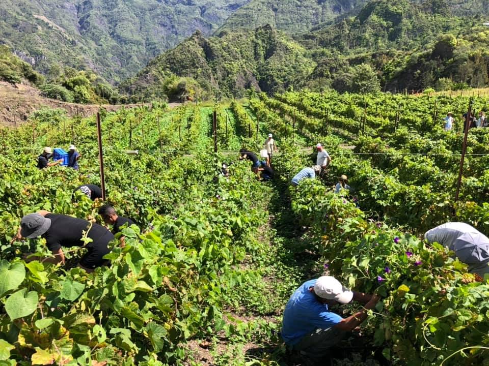
The first trellises appear in the Cirque de Salazie, in Mare à Citrons, where they spread out to Hell Bourg, ilet à Vidot, grand ilet, Mare d’Affouche. The other circuses follow the trend: Cilaos, ilet du Bras Sec, ilet du Peter Boot, in the Cirque de Cilaos; ilet à Bourse, la Nouvelle, Roche-Plate, in the Cirque de Mafatte, multiply their plantations. Convinced that trellised vine won’t fructify, the creoles set up trellises or rather arbors two metres tall and made of an armature of posts and planks strapped together with agave fibers; they use bamboo and maritime pine for this. The building and maintenance of these trellises, when the violence of the wind makes it necessary to replace them every two to three years, collect a high tribute from the forests which were spared from clear-cutting.
Two plants suffice to cover one square gaulette, 25 square metres. The trellises are raised near the cases15: in their shade, one enjoys the cool air, the chickens peck at the ground which will carry a few planks of vegetables or lentils. Often, also, its branches cover a large area, surrounded by bamboo and banana trees.
Vines which, in the coastal area, accomplish two reproductive cycles per year, can only manage one in the mountains, marked by a torpor signaled by the leaves falling, at the beginning of the cool season. In September, trimming signals a renewal of activity; the flowers appear in December, the grapes form during the rainy season, and, without having reached full maturity, because of the green elements caused by the unceasing flow of sap, they’re harvested in February, in two or three sessions, because they don’t all mature on the same plant at the same time.
The picking is handled by the producers or sold to Chinese shop-keepers who learned to make the wine destined for their customers. Often crushed by hand, they produce an acidic must16 which must have sugar added before fermentation in old wooden containers: low doses, 3 to 5kg per hectoliter, produce a wine from 7 to 8 degrees, acidic, which often becomes piquette17. With the addition of 10 to 15kg per hectoliter, the wine, with an alcohol degree of 13 to 14°, contains an excess of sugar which masks the acidity. Circus wines transported to the coast often restart their fermentation.
The production of sacramental wine, which can only use 3 kilos 500 grams of sugar per hectoliter of must, is done more carefully; it makes use of grapes selected one by one, placed on racks in the sun to perfect their maturation.
Good harvests reach one hectoliter per square gaulette. Despite their musky taste, their acidity, their bad conservation, the wines are sold 40 to 50 CFA francs in Saint-Denis. They’re the main source of revenue of the Circuses’ inhabitants.
However these are also forced to make use of the humblest resources that their mountains can offer them; they harvest palmiste hearts, cress, wild herbs, most notably morelles18, which créole cuisine uses as a condiment with rice under the name of “brède”, the collecting of wood strawberries is an occupation for the cool months. The women of Cilaos craft fine lace with needles.
All the available small harvests are gathered by travelling salesmen: “bazardiers”. Eggs, poultry, butter, fruits, vegetables are packed in the bags hanging from their backs “by the suspenders”, or on bamboo platforms, round, wide and shallow, placed on the head. The bazardier sets off at night, a small lantern in hand, barefoot on the rocky mountain tracks. Four or five hours of walking or rather hopping from one stone to the other brings him to the coastal town where he sells off his inventory with the “local” Chinese, with stall owners at the market, or with specific customers he’ll find by going door to door.
This rudimentary economy translates into such a low quality of life that it earned the inhabitants the nickname of “little whites”. Under-nourished (the average weight of a conscript in 1949 was 50kg), barefoot in all seasons, badly clothed, the men with a short shirt and trousers, women with a straight dress, with an off-white blouse, they show signs of precocious heart fatigue from transporting loads on their heads, through steep paths, from the abuse of very strong vanilla-flavoured coffee, from glasses of rum drunk bottoms-up.
To this physiological misery are added the moral consequences of isolation, responsible for the frequency of consanguineous weddings, for the degradation of morals, for the stagnation of mindsets, for ignorance. Because the characteristic of the settling of the circuses is the dispersion of the settlements in areas that are difficult to reach. With the exception of a small number of settlements that deserve the name of “village”, Salazie, Hell Bourg, Cilaos, the houses are spread out in “ilets” or “ilettes”: hamlets or convergences of a few cases, grouping together the posterity of a same family, usually named after the founder; Ilet à Vidot, or one which is a geographical curiosity: Ilet des Mares. This location was chosen either because of its appropriateness for agriculture, heaps of rockfall and well-irrigated flats; either for the safety it could offer in the early days of colonization: rocky meanders, steep cliffs; such as the location of l’ilet à Cordes, in the Cirque de Cilaos, which was accessed using ropes.
The houses consist of mean rudimentary cases of wood or straw covered in grasses or corrugated iron; the most well-maintained outside walls and roofs are covered in imbricated slats of tamarin19 or “thin wood”. Next to the dwelling, a basic shelter is provided for livestock: farm yard animals, cows, pigs. The entire structure is often surrounded by walls of dry stone, hedges, or dead branches.
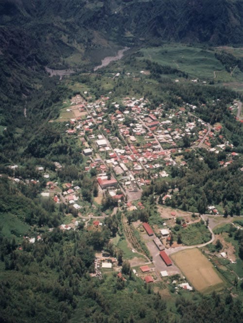
Local travel makes use of a network of quick paths whose stones were worn smooth by bare soles, only accessible to messengers. To travel from one circus to another, family relations travel through ill-delineated forest paths, which rise snaking up the ramparts. For a long time the coast could only be reached by paths impossible to drive on with a cart; the first strangers to try their luck inside the mountains were Chinese shopkeepers who practiced barter in their “cantinas”. The priest and the teacher followed. Still today, the Cirque de Mafatte, lacking a passable road, lives isolated from the outside world; there are about 4000 people abandoned to themselves, who receive occasionally the visit of a priest or a doctor.
Luckier, because the city-dwellers chose them as summer residences, Salazie and Cilaos have roads and hotels. Cilaos can brag about having the most audacious road and the most luxurious hotel on the island; Salazie, about having 11 schools. But the opening of communications lead to the infiltration of the blacks, squeezed too tight on the coasts; the métissage is creeping upwards.
The circuses thus cease to be the refuge where the descendants of the first Breton, Norman and Provençal colonials who lost everything in the lowlands, thought they could maintain their social independence and the integrity of the white race.
A double goal that the evolution of the island’s economy prevents it from reaching.
The development of a speculative colonial monoculture such as sugar cane caused a powerful call for manpower, first servile, then hired under contract, and a trend of concentration of physical property that was accelerated by the abolition of slavery and the intervention of industrial capitalism. Slavery was succeeded by wage work and sharecropping, first reserved for emancipated coloured populations. But the gradual impoverishment of the whites, deprived of land and burdened by children, reduced them to the quality of life of the blacks whose social condition they had to learn to adopt. From that moment on, nothing stood in opposition to métissage.
The coastal plains have reached that level. The development of infrastructure ends the isolation of the inside of the island which had allowed it to act as a preserve for the white race. From now on, demographic exchanges take place between the lowlands and the highlands. Some believe they’ll go more and more from the coastal plains to the circuses, whose colonization isn’t completed. On the contrary one could predict that the “little whites” stuck in their mountains will come down.
The original figure from the article is completely destroyed by artefact compression, so accept this replacement instead.
The “métropole” is the French expression meaning the area where the colonies are ruled from, and refers to modern-day France. It’s still used to this day in relation to the ex-colonies.
A member of the fungus order Pucciniales, this is one of the most economically important coffee diseases, able to inflict double-digit losses in productivity to entire countries.
Wooden appliance used to smoke meats in tropical colonies of the time.
Rubus alceifolius, one of the most troublesome introduced invasives currently on the island.
A type of dry, Mediterranean vegetation typical of the Provence region of France.
The CFA (“communauté financière africaine”) franc was created in the late forties for trade with the French colonies and more broadly Africa. At the time this text was written, 1 CFA franc was worth 2 French francs. Thus one ton of sugar cane made a little over 4 modern euros, close to 5 dollars, for the farmer.
Described as basically sharecropping, but I figured I’d keep the French word at least once for people who’re interested in looking into it further
A unit of surface invented on Réunion, and used from the early 18th century onwards, mostly for establishing plots of arable land. French authorities have tried to eliminate it to replace it with metric since the mid 19th century, but it’s only the recent modernisation of the island that rendered the unit obsolete, now only used by old people. One gaulette measuring approx. 4.87m, it was often rounded to 5 metres in the metric era.
Still a relatively commonplace, and as far as I know, neutral, French term to describe the mixing of different populations living together. This term is often quite intimately associated with the people of ex-colonies, along with the term “métis”, which is simply a person of mixed heritage but can literally be defined as “the product of métissage”.
The largest administrative unit in France after the country’s government itself. They have some level of devolved local power, although the French state is still quite centralised compared to other countries.
The tree Casuarina equisetifolia, introduced to Réunion for wood and erosion protection on the coastline. Now considered an invasive because of its ability to quickly colonise disturbed environments, even if monospecific forest plantations of the trees still exist to this day.
Several tree species of the genus Acacia were planted on Réunion, under the vernacular name “mimosa”.
The old colonial name for Réunion. Mostly used today for touristic or adversiting purposes (be careful though, “Bourbon vanilla” isn’t from Réunion but Madagascar, because of copyright trickery).
Name for a typical “old-fashioned” Réunion settler’s house, usually small and spartan.
The product of crushing grapes, which will be fermented into wine.
Piquette is a term for cheap bad wine.
Members of the tomato family Solanaceae, although here it’s the green parts that are eaten and not the fruits.
Acacia heterophylla is an indigenous tree of altitude rainforests which typically has a straight, narrow trunk and can grow more than 10 metres tall.